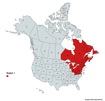
The northeastern United States, including Maine, New Hampshire, Vermont, Massachusetts, Rhode Island, Connecticut, New York, New Jersey, Pennsylvania, Delaware, District of Columbia, Maryland, Virginia, West Virginia, Ohio, and Michigan.
Eastern Canada, including Ontario, Quebec, Newfoundland and Labrador, Prince Edward Island, Nova Scotia, and New Brunswick.
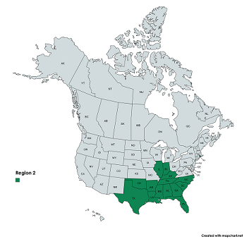
The midwestern and southern United States, including Illinois, Indiana, North Carolina, South Carolina, Georgia, Florida, Tennessee, Arkansas Alabama, Mississippi, Louisiana, Oklahoma, and Texas.
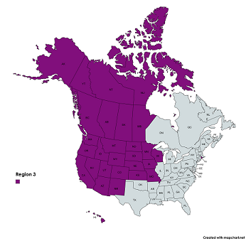
The central and western United States, including Wisconsin, Minnesota, Iowa, Missouri, North Dakota, South Dakota, Nebraska, Kansas, Montana, Wyoming, Colorado, New Mexico, Idaho, Utah, Arizona, Nevada, Washington, Oregon, California, Alaska, and Hawaii.
Western Canada including Nunavut, Manitoba, the Northwest Territories, Saskatchewan, Alberta, Yukon, and British Columbia.
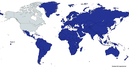
All countries and territories other than the United States and Canada.
